Astronomie
/ astronomía / astronomy
|
|
|
- Die
Erde ist eine Kugel - die Erde ist
RUND - die Erde ist ein Oval
(Palomino 2017)

1. Flugzeugrouten
über die Pole hinweg -- 2. Der
Erdschatten bei einer Mondfinsternis
ist RUND -- 3. Die Flotte von
Magellan schaffte die ErdumRUNDung
1519-1522 (eines von 5 Schiffen) --
Die Weltumrundung der Flotte von
Magellan - Zwischenfälle, Strapazen
und Verluste -- Die Erdumrundung von
Francis Drake 1577-1580 -- 4.
Pythagoras, Platon und Aristoteles
wussten, dass die Erde eine Kugel
ist -- 5. Astronomen haben den
Erdumfang schon vor über 2000 Jahren
berechnet -- Eratosthenes berechnet
erstmals einen Erdumfang: 7º
Sonnenstrahl-Abweichung zur
Mittagszeit zwischen Alexandria und
Syene (heute Assuan) -- Die
abgeplattete Erde -- Ptolemäus mit
der Kugel-Erde im geozentrischen
Weltbild -- Galileo Galilei und das
heliozentrische Weltbild -- 6.
Weltkarten: Zuerst waren es Scheiben
- dann waren es Rechtecke - dann kam
die Mercator-Projektion mit Gittern
und Längen- und Breitengraden 1569 -
am Ende sind es ovale Karten --
1569: Die Mercator-Projektion:
Kanada, Grönland, Russland und die
Antarktis sind viel zu gross
dargestellt -- Ovale Weltkarten mit
annähernd realen
Grössenverhältnissen
Globus mit real
kleinem Grönland
|

Weltkarte von 1990
ca., bauchig-oval

|
- La
Tierra es un globo - la Tierra es
REDONDA - la Tierra es un óvalo
(Palomino 2017)

1. Rutas de
vuelos pasando los polos -- 2. La
sombra terrestre durante un
eclipse lunar es REDONDA -- 3. La
flota de Magallanes completó la
vuelta con su viaje ALREDEDOR del
mundo 1519-1922 (una nave de 5
naves): La vuelta alrededor de la
Tierra con la flota de Magallanes
- casos, dificultades y pérdidas
-- La vuelta alrededor de la
Tierra de Francis Drake 1577-1580
-- 4. Pitagoras, Platón y
Aristoteles sabían que la Tierra
es redonda -- 5. Astrónomos han
calculado la circunferencia
terrestre antes de 2.000 años ya:
Eratóstenes calcula la
circunferencia la primera vez: 7º
grados de aberración de rayos
solares durante mediodía entre
Alejandría y Syene (hoy Asuán) --
La Tierra aplastada -- Galileo
Galilei y el concepto mundial
heliocéntrico -- 6. Mapas
mundiales: primero fueron discos -
después rectángulos - después la
proyección de Mercador con rejas y
grados en 1569 - al fin las mapas
son óvalos -- 1569: La proyección
de Mercator (Mercador)
Mapa de Toscanelli 1474
- eso fue el mapa de Colombo mostrando
Japón al otro lado del Atlántico...
|

Aberración del ángulo de la posición del
sol: 7 grados

|
- Astronomy:
Earth is a GLOBE - Earth is round -
Earth is an oval

1. Flight paths
(air tracks) passing the poles -- 2.
Earth shadow during a lunar eclipse
and sickle moon is ROUND -- 3.
Magellan's fleet completed the tour
aROUND the Earth 1519-1522 (1 of 5
ships) -- The tour around the world
from Magellan - accidents, stress
and losses -- One more tour around
the world by Francis Drake 1577-1580
-- 4. Pythagoras, Platon and
Aristoteles knew that Earth is a
ball / a globe -- 5. Astronomers
calculated the Earth's circumference
before more than 2,000 years already
-- First Eratosthenes calculated the
Earth's circumference: 7 degrees
aberration of sun's position during
midday between Alexandria and Syene
(today's Assuan) -- Flattened Earth
-- Ptolemy with Earth in form of a
ball in a geocentric vision of the
world -- Galileo Galilei and
heliocentric vision of the world --
6. World maps: first there were
discs - then there were rectangles -
then Mercator projection came with
nets and longitude and latitude in
1569 - at the end the maps are ovals
-- 1569: Mercator projection and
faked shapes of Canada, Greenland,
and Russia -- Bellied world maps
with more real dimensions of the
continents
Map by Piri Reis of
1513 fits into a world map with Cairo as
it's center
|

Real form of Earth: Earth is a flattened
oval globe, scheme

|
|
|
|
|
|
|
|
|
Rotierende Erde gif klein

http://www.gif-star.com/weltall/erde/erde1.htm
Rotierender Globus gif:

http://www.animatedgif.net/earthglobe/earthglobe5.shtml
Rotierende Erde gif

http://www.animatedgif.net/earthglobe/earthglobe3.shtml
Rotierende Erde mit Wolken gif

https://giphy.com/search/rotating-earth
Mondfinsternis gif

http://www.animatedgif.net/earthglobe/earthglobe2.shtml
Erde dreht sich um die Sonne, Mond dreht sich um
die Erde
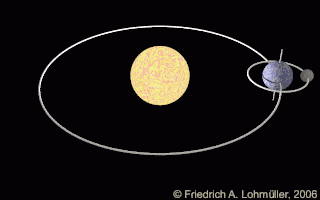
http://bestanimations.com/Earth&Space/Earth&Space2.html
Sonnensystem

http://bestanimations.com/Earth&Space/Earth&Space2.html
http://bestanimations.com/Earth&Space/Earth&Space2.html

http://www.evangelchristianschool.org/news/wp-content/uploads/2009/10/earth_latitude_longitude_lines_hg_clr.gif


